


THE PERUVIAN COASTAL DESERT: AGRICULTURE AND RESILIENCY
USA, 2018
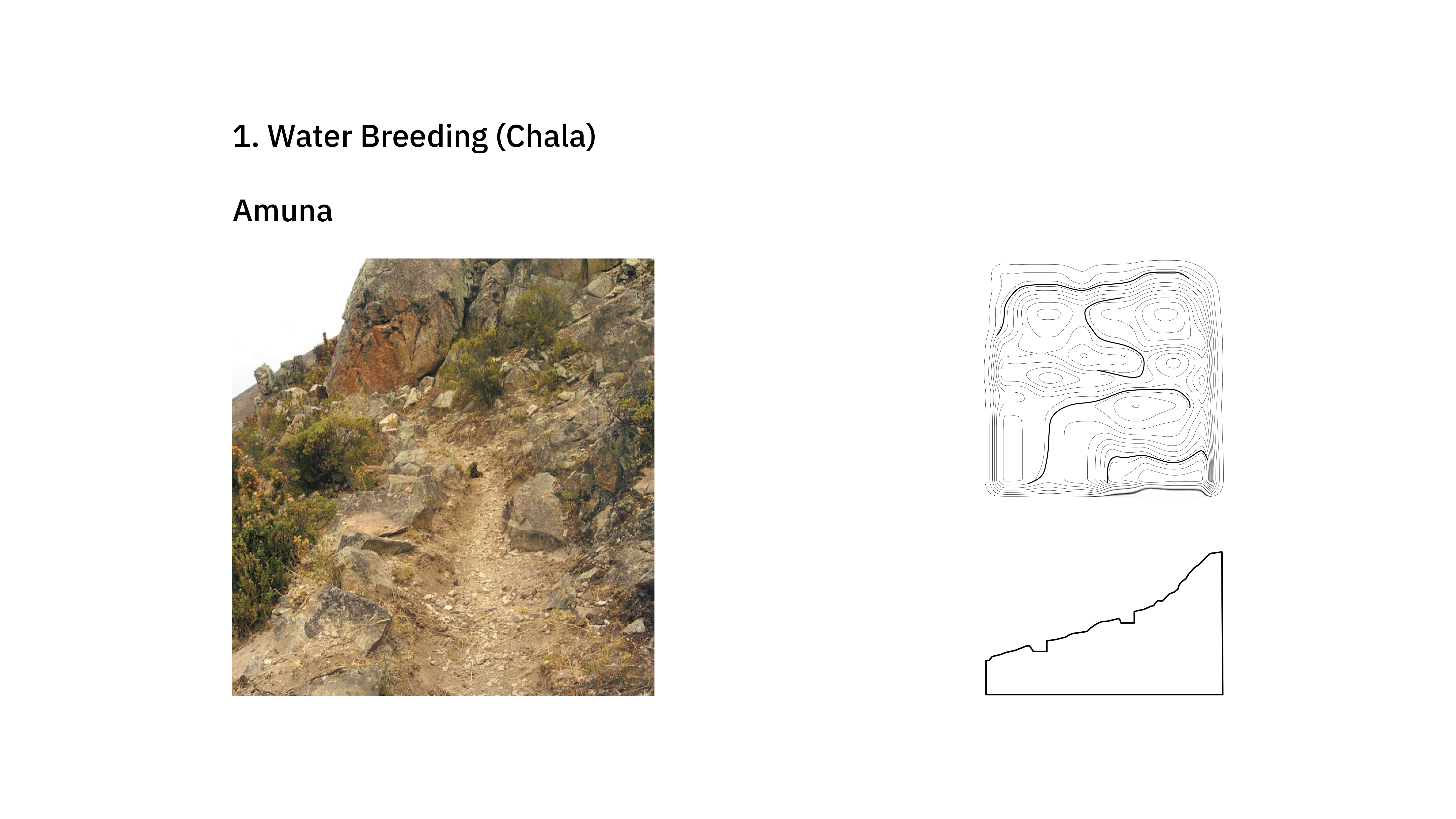
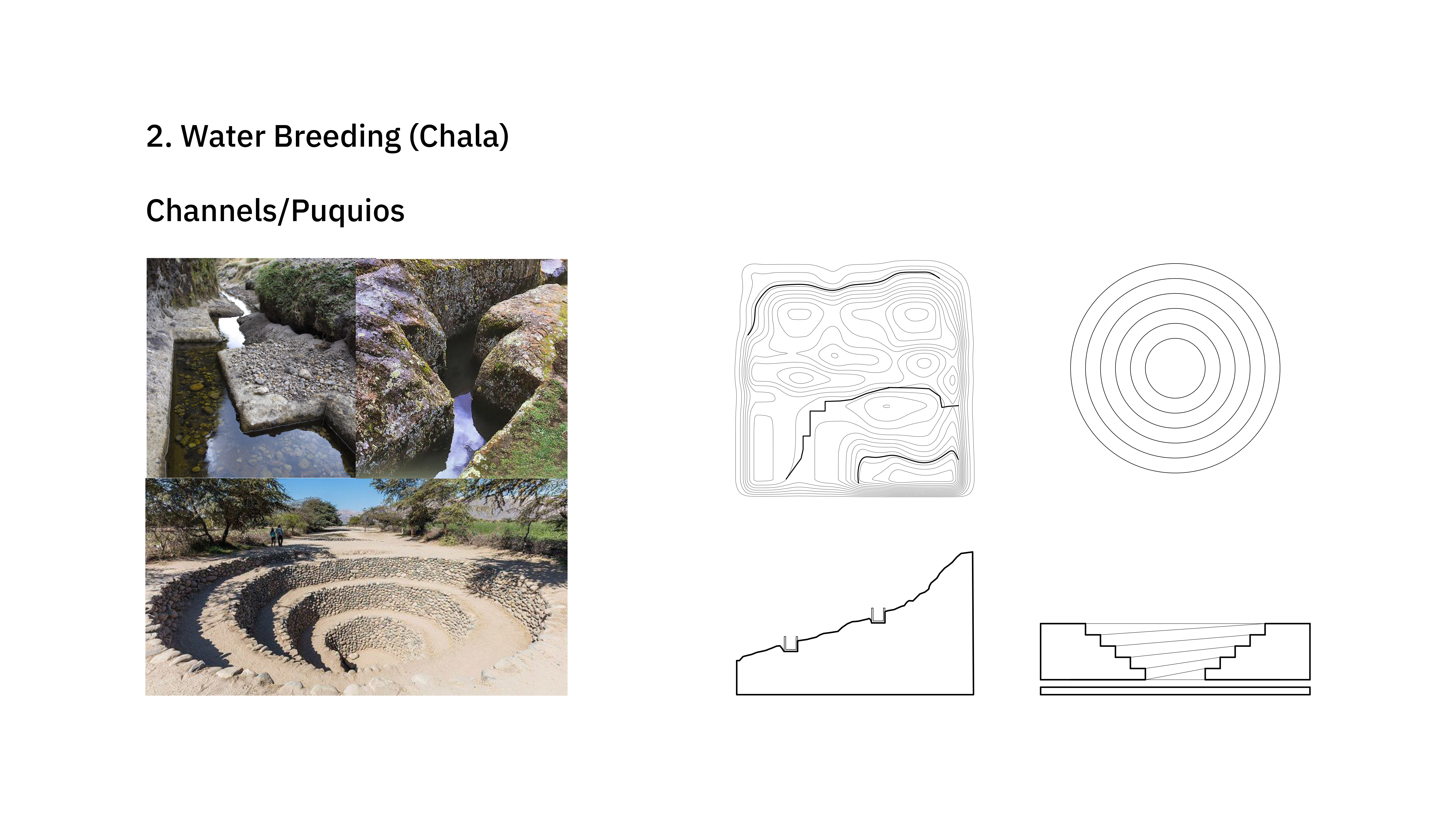
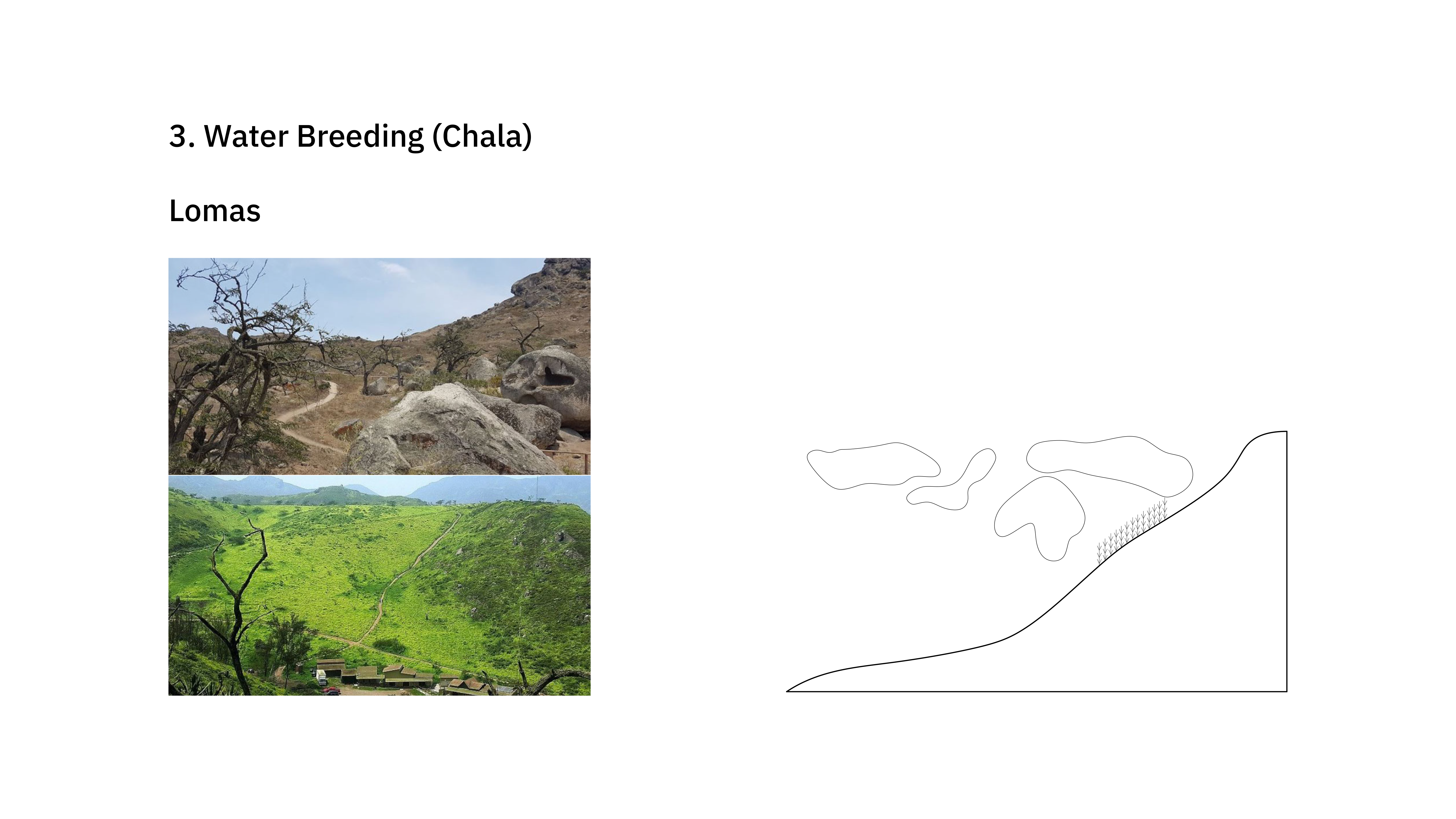
Looking down from the Andes, the fog begins to dissipate and you can slowly descry a narrow, yet rich coastal plane. The Peruvian desert smoothly expands over rivers, valleys, cities and the ocean. Sometimes the coast unfolds gently into the horizon, other times, the relationship is more abrupt with cliffs dropping off into the sea. These varied geographical features set the base for an incredible range of infrastructural pieces, which during pre-hispanic times (900 BCE - 1100 CE) acted as a network, together creating a performative coastal desert - mitigating landslides, managing stormwater and preventing rivers to overflow.
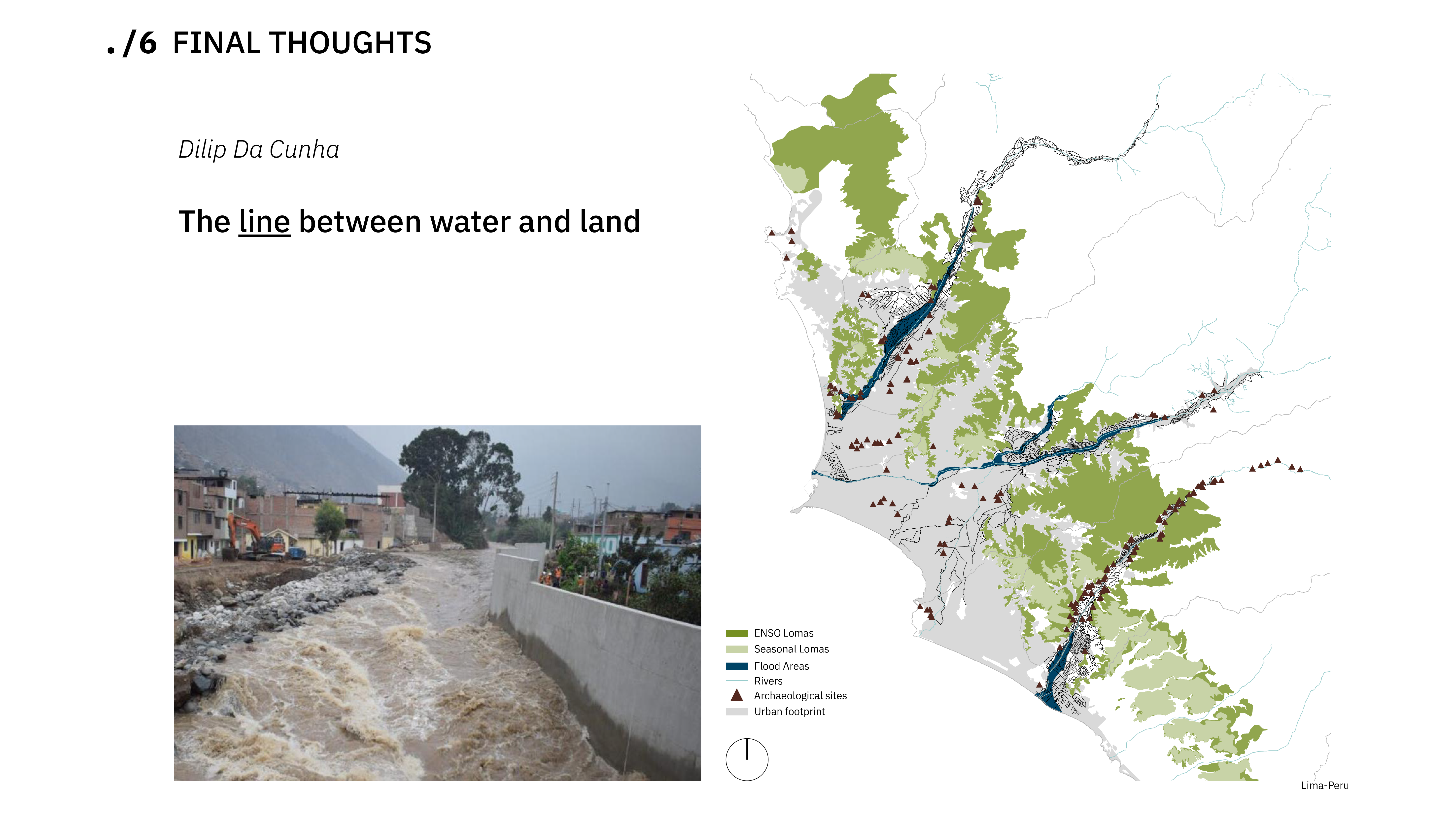
The Peruvian coastal desert runs a total length of 1555 miles. Covering only 10% of the country’s territory, it holds more than 50% of the entire population. Although the coast represents one of the driest landscapes in the country, it faces intense flood events on a cyclical basis as a consequence of El Niño. Dating back to the Holocene, the infamous El Niño southern oscillation is a climatic phenomenon and it is attributed to variations in the temperature of ocean surface, bringing heavy rains and floods and historically leading to tragedies of plagues and water/food shortages. In February 2017 alone, the country marked 158 flood related deaths and the displacement of 1372 people. However, this event is responsible for another effect in the desert. Water collected from intense flooding makes the land fertile for certain produce like corn beans and squash, transforming the desert into a resilient resource.
Evident in records and ruins from pre-hispanic civilizations that inhabited the desert such as Paracas, Mochica, Chimú, Nazca, Tiahuanaco, Lambayeque and Cupisnique, an extensive variety of agricultural techniques designed for various ecological zones and climate patterns also served (and in some cases continue to serve) as a water management network, able to mitigate possible flooding events. In the floods of February 2017 a pre-hispanic aqueduct acted as a dam in the area of Pampa de Mocán (La Libertad), protecting the adjacent town from flooding and redirecting the water to the non-urbanized desert.
This study aims to compile a comprehensive view of the pre-hispanic resilient agricultural infrastructures along the entire coast of Peru through mapping visualization, with the goal of understanding the rich network of planning and performance at a regional scale. Seen collectively, each individual intervention could be understood and analyzed in the context of a larger constellation of infrastructure, functioning both as flood mitigation and crop irrigation. This research would seek to map the impacts of El niño today, with the ultimate hope of unveiling potential opportunities for the rehabilitation of ancient infrastructure or the development of new strategies.